Lake Lanier GPS Fishing Spots
Get our Lake Lanier GPS fishing spots for fishing Lake Lanier this season! Get on the lake today with more than 200 fishing spots across Lake Lanier with GPS coordinates and comments on each fishing spot. Own some of the best fishing spots across the Lake with our GPS product. You will never need paper GPS charts or laminated fishing maps again. Fish the north or south end of Lake Lanier with top fishing spots for Striper Fishing, Bass Fishing, Spotted Bass Fishing and Crappie Fishing, all precisely organized and labeled by local guides and select traveling pro’s. Import all of these fishing locations to your marine GPS (see supported GPS Brands) in one shot using a simple SD card! Also, you can view your Fishing spots and fishing spots comments anytime or anyplace using our included Google Earth fishing map file that works with iPhone and Android devices.


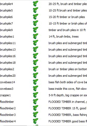
Lake Lanier Fishing Spots for GPS or Mobile! Easy to use copy and paste GPS files are included for Garmin, Humminbird, Simrad, Lowrance and Raymarine GPS models that accept an SD Card. Also, our spots work with iPhone, iPad, Android, Droid and Computers using Google Earth. Our Lake Lanier Fishing spots offer fishermen superb Striper fishing spots, largemouth and spotted bass fishing spots. We’ve marked some of the top fishing structure and fish habitat including bank timber, rock piles, rock ledges, underwater humps, drop off’s, points, ridges, brush piles, submerged timber, trees fallen from banks, submerged stumps, underwater islands and other bottom structure across Lake Lanier. Fish the Lake for Largemouth Bass, Stripers or Striped Bass, Spotted Bass, Walleye, Yellow Perch and more. Lake Lanier Brush Pile locations are found on most of our hump and point spots just off underwater Islands across the lake.
A word from the Pro’s – Using our fishing spots, look for the drop offs from points and humps and you’ll locate those infamous Lake Lanier Brush Pile Fishing Spots regularly, along with many other structures. With Lake Lanier at full pool levels of 1071+/- ft. ASL, fallen trees (aka bank timber) fully in tact with full tops are prime targets as big bass season approaches. As a group, we have marked dozens of recent bank timber and fallen trees/tree tops as these are prime Bass holding structures at full pool levels. The full pool covers the fallen trees, brush and timber allowing anglers to target Lake Lanier Largemouth in shallow water with good cover to hold the fish, especially at spawn.


Lake Sidney Lanier Fishing Spots facts about the Lake: Lake Sidney Lanier is a Corps of Engineers Lake and spans nearly 38,000 acres. The lake boasts superb fishing action with the prime target of Stripers or Striped Bass, Spotted Bass and Largemouth Bass. Stripers are most commonly targeted in Lake Lanier and average a common weight of 2-5 pounds, but are commonly caught over 15 pounds as reported by our fishermen. Spring, Summer and Fall are the top times to fish on Lake Lanier, although many Striped Bass and Spotted Bass are caught in winter months in deep water or creek/channel entrances where good water clarity is found.
Lake Lanier Fishing Fishing Map for GPS. Below, our Lake Lanier fishing spots are shown loaded to a GPS using our included GPS file copied to a blank SD Card, then into the GPS. —NOTE: Actual GPS views, map details and fishing spots comments will vary depending on which (if any) Lake Maps, contour maps or other maps installed on your GPS. Add our fishing spots to your GPS and hit the Lake with an arsenal of top fishing spots for Bass, Crappie and Striper fishing. Good spots are absolutely necessary for fishing success at Lake Lanier.

Below, see a zoomed out image of our Lake Lanier Fishing spots mobile file opened with Google Earth and our custom designed Google Earth Lake Map overlay. These Google Earth files allow anglers to view these fishing spots and fishing spots comments anywhere.. anytime! This included file works with computers or mobile devices using the free Google Earth app and others suggested after purchase.

Purchase Lake Lanier Fishing Spots – New customers, this season you don’t need a referral to purchase! Our most popular option is the (DIY) do it yourself files below. You will receive your files by email after purchase for GPS and Mobile, or choose the pre-loaded to SD card option to have the spots loaded to an SD Card for your make and model GPS, ready to load and mailed to your front door, shipping included! (click to check or un-check proper boxes. Select only one option below)
Lake Lanier Pro Fishing Spots
As Always, Purchase Securely and with Confidence from the Coastal fishing group. We’re a 15 Year Verified Secure and Trusted Seller
with a 5-star rating and 100% positive seller feedback in the Merchant arena. See our secure Verification.
Important and helpful Fishing Information – Learn more about Lake Lanier Fishing | Lake Lanier Fishing Report
Important Note: Sharing these fishing spots is strictly prohibited by our guides. Please don’t share your coordinates with others to prevent over fishing of these spots. Only a pre-selected number of fishing spots are sold each season to helpcontrol over fishing by limiting the number of fishermen who can purchase these spots. The fishing spots will then be available the following season as present customers receive updated spots. This rotation of fishing spots has been proven to help prevent over fishing on Lakes when fishermen do their part. Thank you for your cooperation as professional fishermen and thank you for business! Fish on!